RESTI DI STRUTTURE PRODUTTIVE ED ABITATIVE DI ETA' PRE-ROMANA E ROMANA
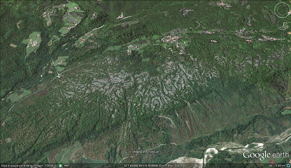
On the edge of Ivrea’s morainic amphitheatre, a long, narrow plateau tells an unexpected story. This fluvio-glacial terrace, eight kilometres by little more than one, was not just shaped by ice and water but by centuries of intensive gold-working. The landscape is pitted and hummocked: heaps of rounded stones rise from the upper terrace, the debris of ancient placer mining, while the lower terrace rolls in broad, gentle swells formed from the waste sands and gravels of the same industry. These are not random spoil heaps. Look closely, and the mounds run in converging furrows, guiding water towards channels that widen into broad, flat basins, their edges still marked by dry-stone walls, the remains of settling tanks. Here, the Romans and their predecessors dug, sluiced and sorted, leaving a topography that is as much a relic of industry as of nature. Protostoric traces linger too, a deeper, older layer beneath the Roman enterprise.
Description via source. Coordinates and heritage data from the Atika atlas.