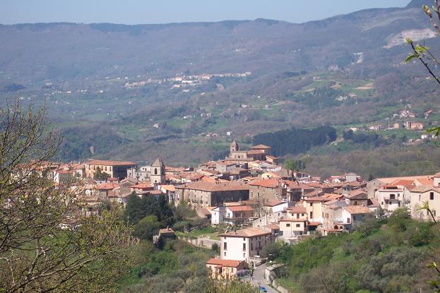
centro storico, montano, di crinale, lineare, Rogliano, Rublanum (denominazione storica, fino al X sec.), Rubilanum/Rublani (denominazione storica, cit. 1326)
The old centre of Rogliano, known historically as Rublanum until the tenth century and later as Rubilanum, strings along a narrow ridge in the Savuto valley. This is a linear borgo, a mountain settlement shaped by its geography: to the south the slopes fall away steeply, while the northern side is softer, cut by small streams. The urban plan, largely defined in the seventeenth century, follows the crest like a horseshoe, its edges essentially the mountain’s own declivities. The town is divided into distinct rioni, Cuti, Rota, Donnanni, Spani, Patinelli, Serra, each with its own parish church, a piazza with a fountain, a noble palazzo, and rows of modest houses set side by side. Key vantage points include Piazza San Domenico, a belvedere with a public garden, and the junction of Via Stazione and Via Nicoletti. The spine of the settlement is the former SS 355, now the provincial road 241, from which matrix streets like Via Regina Elena and Via Bendicenti descend. This is a place where the medieval and early modern rhythms of ridge-top life remain legible in the stone.
Description via source. Coordinates and heritage data from the Atika atlas.