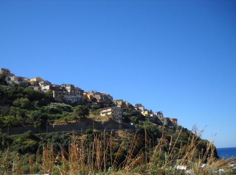
centro storico, lineare, difensivo, Cetraro, Citrarium (denominazione storica), Castrum Citrarii (denominazione originaria, 1097)
The historic core of Cetraro, once known as Citrarium and documented as the Castrum Citrarii in 1097, is a linear, defensive Byzantine borgo. Its layout is a direct response to the land: a narrow coastal plain, rising to just 120 metres, where the Tyrrhenian Sea meets the steep, accentuated slopes of the Calabrian coastal chain. This spine of crystalline schist and phyllite, part of the Calabride Complex, forms a rectilinear ridge, a sublittoral continuation of the Apennines. The geology is one of ancient, metamorphosed rock, its fractured permeability low, while the hydrography is that of torrential streams, the Triolo, Aron, San Giacomo, that have shaped the plain through centuries of terrigenous transport. The borgo itself, perched in this narrow margin between mountain and sea, was a practical, watchful settlement; its defensive character is less a flourish than a necessity born of this rugged, constricted topography.
Description via source. Coordinates and heritage data from the Atika atlas.