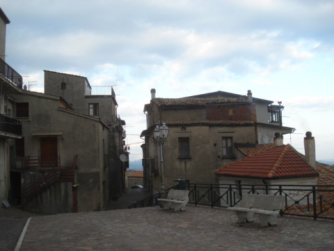
centro storico, di crinale, difensivo, Malvito, Malvitus (denominazione storica, X secolo), Malbitus (denominazione storica, XI secolo)
On a hilltop 449 metres above sea level, to the right of the Esaro river, Malvito’s historic centre keeps its medieval bones visible. The original defensive layout remains: houses stacked on the eastern slope, twisting alleyways, and fragments of the old circuit walls. This was a borgo built for watching, not welcoming.
The geology beneath is complex. The ridge runs northwest to southeast, made mostly of sands and cemented conglomerates, with sub-rounded pebbles. Below, on the gentler slopes, grey silty clays emerge, often loose near the surface. The deeper substrate is older still: schists and garnet-bearing biotite gneisses from the Palaeozoic, part of the Calabrian-Peloritan arc. A shallow unconfined aquifer sits in the porous upper layers.
Malvito was noted in the tenth century as Malvitus, and in the eleventh as Malbitus. The names survive; so does the shape of the place, a Byzantine-era ridge settlement that never quite let go of its fortress instincts.
Description via source. Coordinates and heritage data from the Atika atlas.