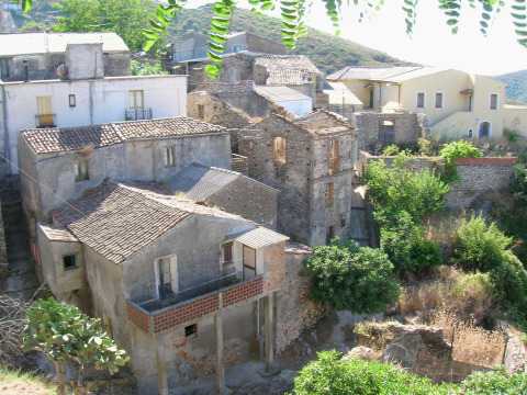
centro storico, di crinale, collinare, agricolo, Pietrapennata
The ancient borgo of Pietrapennata is a Byzantine-era settlement laid out to follow the slope of its hill: the urban plan adapts to the terrain rather than forcing a grid upon it. The main artery is Via Stretto, which runs the length of the village to Piazza Regina Margherita, where the Parrocchiale dello Spirito Santo stands (fifteenth to sixteenth century). Inside is a sixteenth-century statue of the Madonna dell’Alica, attributed to Gagini. Secondary streets, Via Baracche, Via Gorizia, Via Mergoli, Via Larizza and Via Scalone, branch off, with small alleyways knitting the fabric together. Historically, Pietrapennata was a casale of Palizzi; it passed through the hands of the Ruffo, d’Aragona d’Ayerbe, Colonna and Arduino families, the latter gaining a princely title in 1662. The de Blasio held it from 1786 until the abolition of feudalism in 1806. The devastating earthquakes of February 1783, which wrecked much of Calabria and Sicily, caused some buildings here to collapse.
Description via source. Coordinates and heritage data from the Atika atlas.