Polyantho
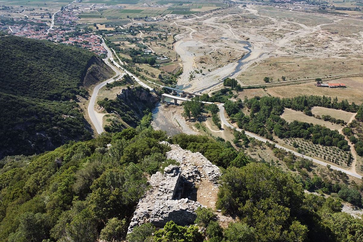
A Byzantine fortress of unknown origin stands on a conical hill above the Kompsatos river, north of Polyanthos village in Thrace. Its position commands the river's exit into the Komotini plain and overlooks the old Egnatia road, with views stretching along the Thracian coast from Maroneia to Avdira. It held visual contact with Mosynoupolis, six kilometres east, and Anastasioupolis, fifteen kilometres southwest. No historical source names it, though it may be among the fortresses surrendered to Mattheos Kantakouzenos in 1344, or those destroyed by the Bulgarian tsar Ivan in 1206; both remain speculation.
The enclosure runs roughly 550 metres, climbing 110 metres from base to keep. Walls of large stones with smaller fill and white mortar survive best on the western and eastern sides, standing up to two metres high and 1.2 to 1.6 metres thick. A thicker corridor wall, 2.5 to 2.7 metres wide, leads to a square keep, six metres across, now half-demolished, showing brick courses and stepped reinforcements. Below stands a seventeenth or eighteenth-century arched bridge, while a Hellenistic fortress and an Early Christian basilica lie nearby.
- Kastra.eu, Castles of Greece · reference
Coordinates and heritage data compiled in the Atika atlas.