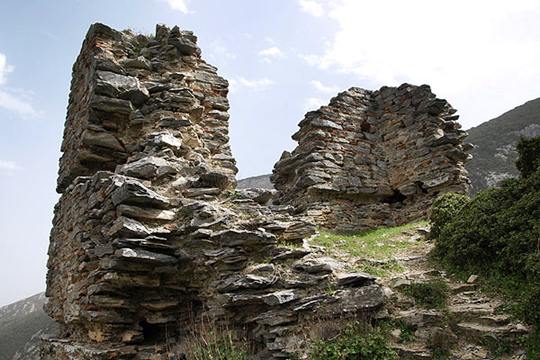
Oria
The castle of Oria stands on a high rock above the Vale of Tempi, on the flank of Mount Ossa and near the spring of Aphroditi. What survives is only a bastion; the main fortress, built lower down beside the Pineios River, was swept away when the modern road was cut through the gorge. The position was always vital, for this narrow valley, barely twenty-five metres wide in places and hemmed by cliffs of nearly five hundred metres, was the principal route from Thessaly to southern Greece. The Byzantines fortified the pass and raised a stronghold they called Lykostomion, and Oria may well be that castle, though proof is lacking. The name means the Fair Lady, and legend tells of a fifteen-century Ottoman siege lasting twelve years. When the Turks finally broke in, the lord's daughter leapt from the rock to her death rather than surrender. The ruins remain, a lonely sentinel over a pass that has known countless armies.
- Kastra.eu, Castles of Greece · reference
Coordinates and heritage data compiled in the Atika atlas.