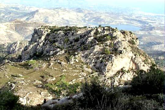
Mesokastela
Mesokastela, whose name translates as “in the middle of castles,” is a natural fortress in ruins, occupying a plateau shielded by four rocks. Two of these carry fortifications, while the space between them offered water springs and cultivable ground. Its great advantage was invisibility: hidden from nearby passes and the sea, yet from the summits one could survey much of Crete’s south coast and the Isthmus of Ierapetra, the island’s narrowest point between the Aegean and Libyan seas. A settlement existed here in Roman and early Byzantine times, but the position served as a refuge from the Minoan age perhaps into the Venetian period. The surviving walls likely date to the second Byzantine era, after the expulsion of the Saracens in the tenth century, when it probably functioned as a military post. Abandoned before the thirteenth century, it appears in no Venetian inventory, leaving its precise history to inference.
- Kastra.eu, Castles of Greece · reference
Coordinates and heritage data compiled in the Atika atlas.